Trekking guide from Inawashiro Tozanguchi (Trailhead) to Mt. Bandai
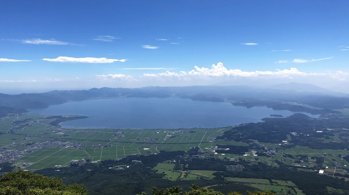
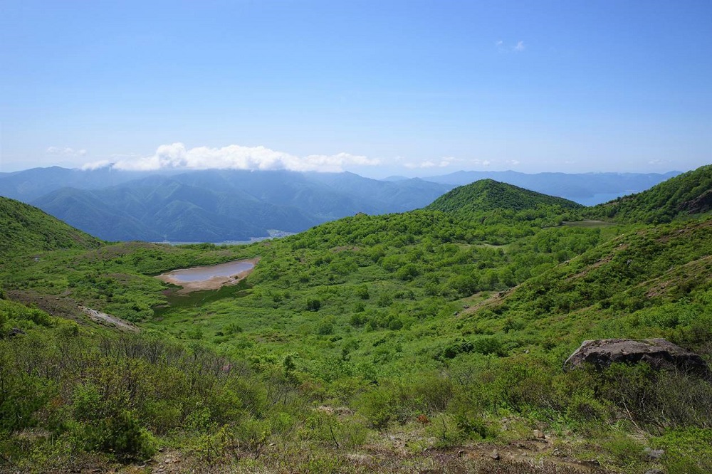
Enjoy walking through Numanodaira moor full of alpine plants, looked upon by Mt. Bandaisan, Mt. Akahaniyama, and Mt. Kushigamine with Lake Inawashiro down below. Lake Inawashiro is the forth largest lake in Japan, and is also known as Tenkyo-ko, "Heaven's Mirror" in Japanese. The Inawashiro Tozanguchi route is the only way to enjoy these magnificent views.
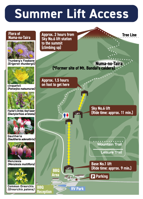
Summer lift for climbers(Up and down rides are possible)

The lift is available for hikers during the summer and takes you to an altitude of 1,100m in 20 minutes, allowing you to reach the summit with only 2 hours of trekking in total. You can ride the lift both up and down, so it is also recommended for beginners.
Operation hours:Jul 12, 2025 (Sat) - Nov 3, 2025 (Mon) *Weekends & Holidays Only
For groups, it is possible to consult about operation support even on non-business days. Please contact us.
*The lifts will run every day from July 19 (Sat) until August 31 (Sun) 2025.
*The operation is subject to change or suspend due to weather conditions and other factors.
Place: No. 1 Quad in Base Slope and No. 6 Pair in Sky Slope at Inawashiro Ski Resort
Operation hours: No. 1 Quad 7:30AM-3:00PM(Up lift ends at 2:30PM), No. 6 Pair 7:30AM-2:40PM(Up lift ends at 2:10PM)
【Extended operation of summer lifts during the Obon period (peak season)】
Term :August 9th (Sat) to August 17th (Sun), 2025 (9 days)
Operation hours: No. 1 Quad in Base Slope 7:30AM-4:00PM (Up lift ends at 3:30PM)
No. 6 Pair in Sky Slope 7:30AM-3:40PM (Up lift ends at 3:10PM)
※60 minutes longer than usual
*The operation may be changed without notice. Please confirm the operation status before you visit us.
*The standard time required for mountain climbing is just a guide and may vary from person to person.
*Please plan according to your own physical strength and experience, and prepare sufficient equipment and personal belongings according to the route and weather conditions.
Summer lift fare (one way)
| Fare table | One-time fee | Connected ride (two time rides) fare |
|---|---|---|
| Adults (junior high student or above) | 800 yen (incl. tax) | 1,600 yen (incl. tax) |
| Children (elementary school students) | 600 yen (incl. tax) | 1,200 yen (incl. tax) |
| Preschool children (4 year and older) Applicable for one child per adult |
300 yen (incl. tax) | 600 yen (incl. tax) |
| Pet (One adult must accompany per pet, or per cage) |
600 yen (incl. tax) | 1,200 yen (incl. tax) |
- *Pet cage width/depth/height must be 60cm or less respectively in order to be securely seated on the lift chair.
- *Regardless of the cage size, we may have to reject your pet ride subject to pet/cage conditions or at the discretion of the lift operators.
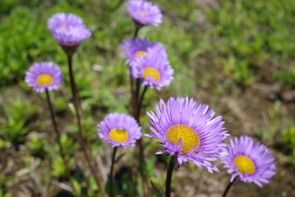
Alpine Plants of the Three Peaks of Mt. Bandai (Mt. Bandai, Mt. Akahaniyama, Mt. Kushigamine)
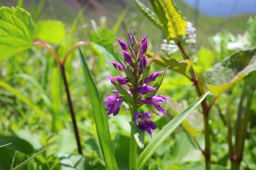
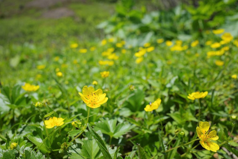
You can enjoy the onsen (hot spring) at villa Inawashiro, 700 yen for adults (junior high school students and above),500 yen for children, open 6:00AM - 9:00AM, 2:00PM-4:00PM, 9:00PM-11:30PM) after trekking. A wonderful bonus only available at Inawashiro Tozanguchi route!
Inawashiro Tozanguchi route
Overview of Mt. Bandaisan trekking routes
| Trailheads | Overview of trailheads | Access | Car parking capacity |
|---|---|---|---|
| Inawashiro Tozanguchi trailhead | The most popular trekking route to Mt. Bandaisan to enjoy neing surroudned by alpine plants while looking out upon Inawashiroko Lake below. |
<By car> Head for Inawashiro Ski Resort from Inawashiro Bandai Kogen IC off the Tohoku Expressway, National Route 115 or Prefectural Highway 7. Parking at Inawashiro Ski Resort is available. <By taxi> About 1,500 yen (3.5 km) from JR Inawashiro Station to Inawashiro Ski Resort |
2,000 cars |
| Urabandai Tozanguchi trailhead | A route to witness a completely different face of Mt. Bandai, scarred by a wild volcanic eruption. |
<By bus> Take a bus for Urabandai Kogen station from JR Inawashiro station. Walk 60 mins from the last stop to Urabandai Ski Resort. <By car> Follow National Route 459 and head for Lake Hibara. Turn left just before the Mt. Bandai Gold Line Entry (you can see a ski resort sign) and head toward Urabandai Ski Resort parking. |
500 cars |
| Shibutani Tozanguchi trailhead | A wonderful route for forest bathing (Shinrinyoku in Japanese) in the deep woodlands. |
<By bus> Take a bus for Urabandai Kogen station from JR Inawashiro station. From Kokusai Ski-jo Iriguchi bus stop, walk up the slope to the ski resort (a sign shows Shibutani Tozanguchi trailhead). Follow the maintenance road across the ski slope, and take the forestry road that leads to the Mt. Bandai trail. <By car> Ski resort parking is available. |
Very little parking is available, be careful when crowded. |
| Kawakami Tozanguchi route | A steep route that climbs up to the towering peak through a majestic tree zone to reach a wild volcanic crater. |
<By bus> Take a bus for Urabandai Kogen station from JR Inawashiro station. From Kawakami Onsen bus stop, walk toward Urabandai for about 500m until you see the trailhead sign. <By car> Follow National Route 459 until you see "Yamanoeki Shokudo" diner. Parking is available in front of the Kawakami Tozanguchi trailhead sign. |
Very little parking is available, be careful when crowded. |
| Okinashima Tozanguchi trailhead | An extremely steep route with scree slopes for climbers confident in their physical strength. |
No bus is avilable, car/taxi access only. <By car> Follow National Route 7 and head for Showanomori. Parking is available in front of the Okinashima Tozanguchi trailhead sign. |
70 cars |
| Happodai Tozanguchi trailhead | A relatively easy route for beginners with less elevation between the trailhead and the summit (on the other hand, the route lacks variety and scenery). |
No bus is avilable, car/taxi access only. <By taxi>About 8,000 yen (26.5km) from JR Bandai station, about 4,500 yen (15km) from JR Bandaimachi station |
50 cars, be careful when crowded. |
- Part of Numanodaira
- Happodai Tozanguchi trailhead (from trailhead to before Koboshimizu point)
- Shibutani Tozanguchi trailhead (Numanodaira from Bandai)
- Urabandai Tozanguchi trailhead (Akanuma pond and just before Koboshimizu point)
Standard Trekking Time
| Trekking Course | Ascending | Descending |
|---|---|---|
| Inawashiro Tozanguchi trailhead | About 2 hours (using lift) About 3.5 hours (without using lift) |
About 1 hour 40 mins (using lift) About 2.5 hours (without using lift) |
| Urabandai Tozanguchi trailhead (via Nakanoyu) | About 3 hours 50 mins | About 3 hours |
| Shibutani Tozanguchi trailhead | About 3 hours 40 mins | About 2 hours 50 mins |
| Kawakami Tozanguchi trailhead | About 4 hours | About 2 hours 50 mins |
| Okinashima Tozanguchi trailhead | About 3.5 hours | About 2.5 hours |
| Happoudai Tozanguchi trailhead | About 2 hours 15 mins | About 1 hour and 40 mins |
What is Mt. Bandaisan?
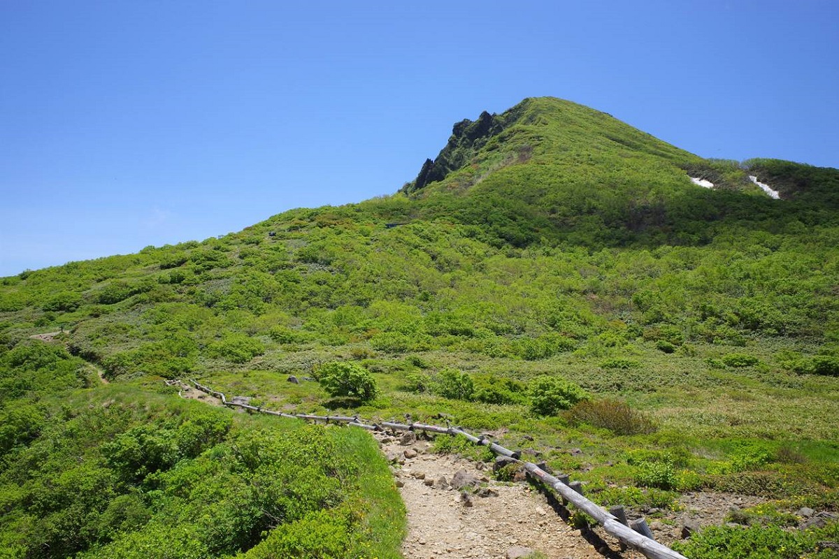
Mt. Bandaisan Charter
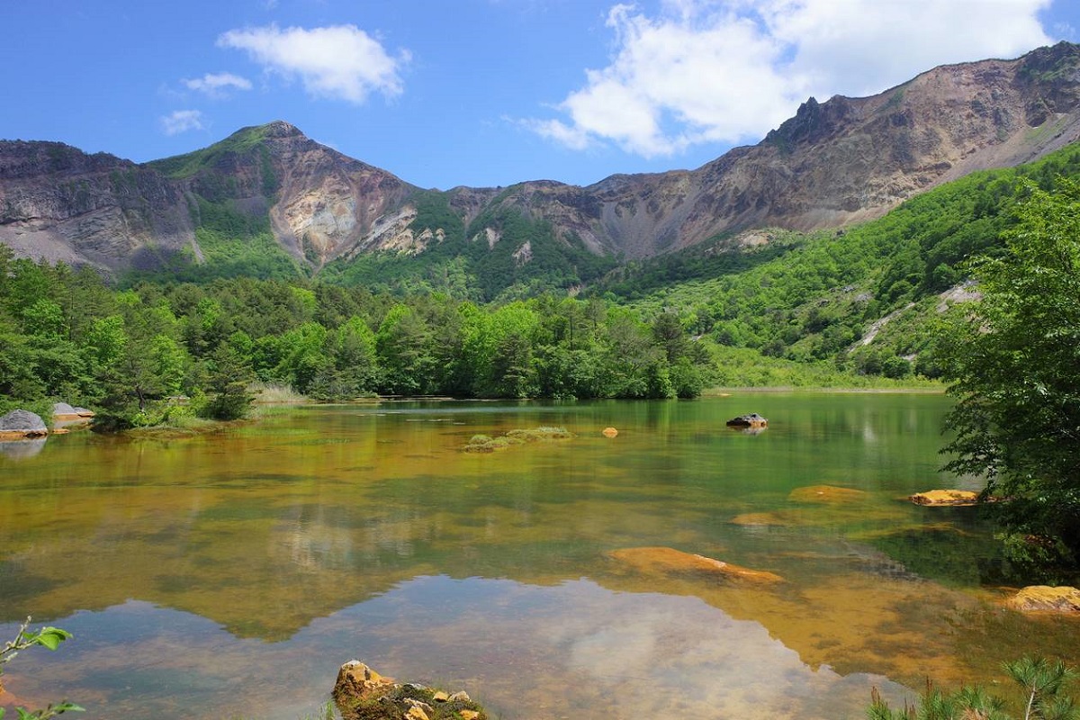
The most recent eruption was in 1888 (Meiji 21) which caused a rock avalanche that took away more than 470 people, and at the same time, left numerous beautiful ponds including Goshikinuma that now embraces a wide variety of lives and attracts visitors with its beauty and scholars with its academic value highly regarded.
Mt. Bandaisan provides us a beautiful scenery, abundant water resources, hot springs, and many other blessings which were deeply appreciated by our ancestors as the base of fruitful and warm lifestyle and culture. However, the beautiful nature of the mountain has been damaged by the modern lifestyles and leisure activities. Once damaged by humans, the precious nature takes many years to restore.
Mt. Bandaisan is truly "a mountain of treasure" as sung in an ancient folk song. It is a wonderful place in terms of its nature, scenery, history, and culture. It is a precious asset to be handed down to the future generations. For these reasons, we must take pride in the nature, landscape, history, and culture of the mountain, protect nature, prevent volcanic disasters, take own initiative to think what each of us can do, and realize a harmony between the nature and human beings. Now we declare that Mt. Bandaisan is an asset and a treasure for local residents. We promise to come together with love for the mountain, join hands to protect and make a good use of it in a rightful way. We will have a strong determination to worship and take pride in the mountain and hand it down to future. For these purpose, three towns of Inawashiromachi, Bandaimachi, and Kitashiobaramura establish "Charter of Mt. Bandaisan."
Let us learn about the nature, history and culture of Mt. Bandaisan and get to know it well.
Let us appreciate and make a good use of the blessings of Mt. Bandaisan, and realize a harmony between the nature and human beings.
Let us protect the nature of Mt. Bandaisan and make a good use of it in a rightful way.
Let us worship and take pride in Mt. Bandaisan to pass it on to future generations.
Let us each think and act on our own will for the sake of Mt. Bandaisan
September, 21, 2010
Rules for hiking Mt. Bandai
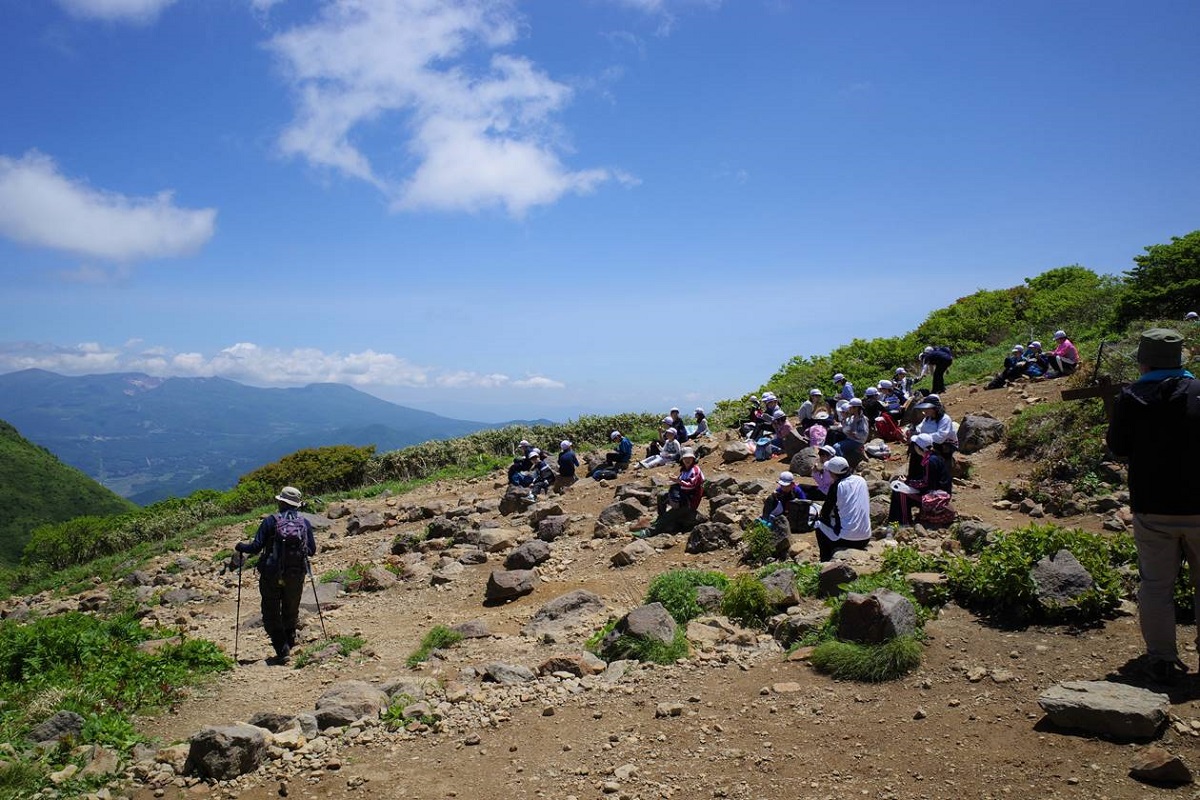
- No toilets are available. Please bring your own portable toilets.
- Do not climb in casual gear or go hiking without proper planning.
- Please carry a map and a compass with you and check your route constantly.
- Have the courage to turn back when the weather is bad, or when you are lost.
- Please do not litter, and keep the trekking route clean for others.
- For the protection of flora and fauna, it is strictly prohibited to step outside the trekking route or to collect plants and trees from the mountain.
- In case of accidents, always fill out a mountain climber card (Tozansha Kado in Japanese) beforehand.
- If you hear a siren while climbing, check the safety of your surroundings and quickly descend the mountain.
- Please stay away from areas where volcanic gases are present.
- Please be careful of bears and always carry bear bells and other protection with you.
Bandai-Asahi National Park
Due to its huge size, the park has various mountains with variety of slopes for beginner and advanced skiers and climbers. It also has hot springs for visitors. Many tourists from Tokyo metropolitan areas choose to visit the park since it has a good access from Tokyo.
Access
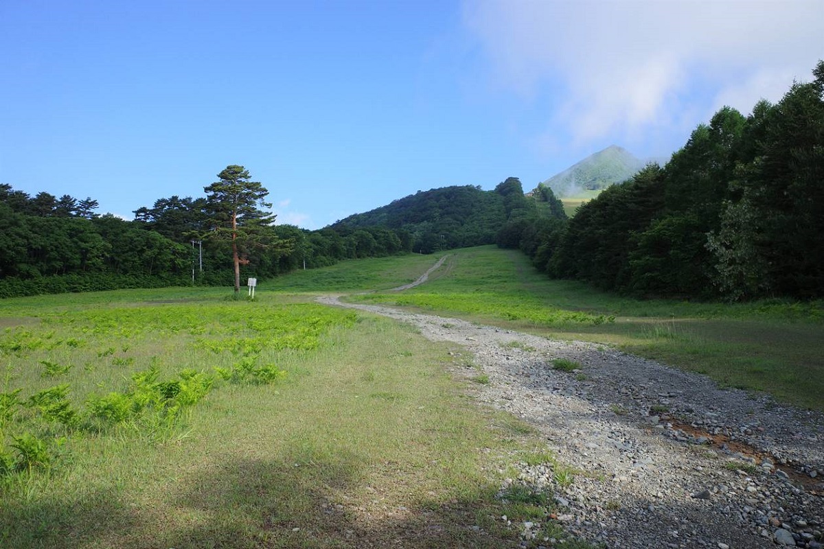
Enter "Inawashiro Ski Resort" as facility name into your car navigation.
Enter "Hayama 7105 Inawashiromachi, Fukushima prefecture" as street address into your car navigation.
For detailed access to the trailhead (Inawashiro) for Mt. Bandai click here.
Photo by bluesky.rash.jp


